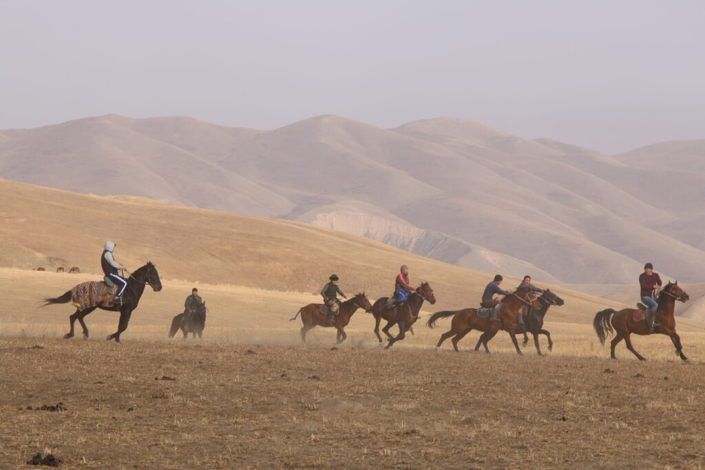
Tian Shan Mountains
Tian Shan Mountains are a great mountain system in Central Asia. Its name is Chinese for “Celestial Mountains.” Stretching about 1,500 miles (2,500 km) from west-southwest to east-northeast, it mainly straddles the border between China and Kyrgyzstan and bisects the ancient territory of Turkistan. It is about 300 miles (500 km) wide in places at its eastern and western extremities but narrows to about 220 miles (350 km) in width at the center.
The Tien Shan is bounded to the north by the Junggar (Dzungarian) Basin of northwestern China and the southern Kazakhstan plains and to the southeast by the Tarim (Talimu) Basin. To the southwest the Alay ranges of Tajikistan extend into part of the Tien Shan, making the Alay, Surkhandarya, and Hisor valleys boundaries of the system, along with the Pamirs to the south. The Tien Shan also includes the Shū-Ile Mountains and the Qarataū Range, which extend far to the northwest into the eastern Kazakhstan lowlands. Within these limits, the total area of the Tien Shan is about 386,000 square miles (1,000,000 square km).
The tallest peaks in the Tien Shan are a central cluster of mountains forming a knot, from which ridges extend along the boundaries between China, Kyrgyzstan, and Kazakhstan; these peaks are Victory Peak (Kyrgyz, Jengish Chokusu; Russian, Pik Pobedy), which at 24,406 feet (7,439 meters) is the highest mountain in the range, and Khan Tängiri Peak (Kyrgyz, Kan-Too Chokusu), which reaches 22,949 feet (6,995 meters) and is the highest point in Kazakhstan.

Geology of Tien Shan
The mountains of the Tien Shan are composed of the main crystalline and sedimentary rocks of the Paleozoic Era (i.e., about 540–250 million years ago). The basins that lie between the mountains are filled with younger sediments that were formed chiefly by the erosive action of the area’s rivers. Granitic rocks outcrop over much of the area in the north and east of the Tien Shan.
The northern and eastern portions of the region underwent folding during the mountain-building period that occurred during the early Paleozoic; it has been uplifted dry land since that time, and its original sedimentary cover has been almost completely obliterated by erosion. The southern and western parts of the Tien Shan, however, consist principally of sedimentary metamorphosed (structurally changed by heat and pressure) rock and, to a lesser degree, of intrusive and volcanic rock. These regions experienced folding during the late Paleozoic.
A new stage of development began about 25 million years ago and has continued to the present. It has been characterized by sudden movements of the Earth’s crust. Loose rock fragments have slid into the valleys and formed accumulations; those in the Fergana Valley are almost 5 miles (8 km) thick. Shallow lakes were formed in many valleys and later evaporated, leaving behind salty deposits.
Subsequently, glaciers produced moraines comprising boulder-rich sediments in the mountains, while gravel (water-lain sediment) and loess (wind-deposited sediment) accumulated in the valleys. Zones of faulting occur, usually along the boundaries between the ridges and the valleys. Large-scale horizontal movements have occurred along the great Talas Fergana Fault, which traverses nearly the entire Tien Shan system along the northeastern slopes of the Fergana Kyrka Mountains and its northwestern extension. The deep faults are associated with catastrophic earthquakes that occurred at Verny (1887), at Kashgar (Kashi; 1902), in the northern Tien Shan chains (1911), and at Chatkal (1946) and Khait (1948).
Glaciation
The total area of the Tien Shan glaciers is some 3,900 square miles (10,100 square km), of which approximately four-fifths is in Kyrgyzstan and Kazakhstan. Largest among the several glacial areas are the region around Khan Tängiri and Victory Peaks and the Eren Habirg Mountains. There also are many glaciers in the Kakshaal Range, the Ak-Shyyrak Range, the Ile Alataū Range, and the southern Tien Shan. The largest glacier in the Tien Shan is Engil’chek (Inylchek) Glacier, which is approximately 37 miles (60 km) long; it descends from the western slopes of the Khan Tängiri massif and branches into numerous tributaries. Other large glaciers in this area include North Engil’chek (24 miles [39 km]) and Muzat Pass (21 miles [34 km]). The length of the largest Tien Shan glaciers elsewhere is usually between 6 and 12 miles (10 and 19 km); the most usual size is that of the relatively small valley glaciers, from about 1.5 to 3 miles (2.4 to 5 km) long.
The glaciers are usually fed by snowfall on the glaciers themselves or by snow avalanches from the surrounding slopes. Glacial action in the Tien Shan apparently is decreasing; most glaciers are either receding or standing still. Since the mid-20th century, however, large glaciers in the inner Tien Shan region have made short-term advances. The glaciers of the Tien Shan feed many large rivers, including the Naryn, Sarydzhaz, Ili, Aksu, and Zeravshan.
